Thursday, October 6, 2011

California 2011 Part III: Clover Creek


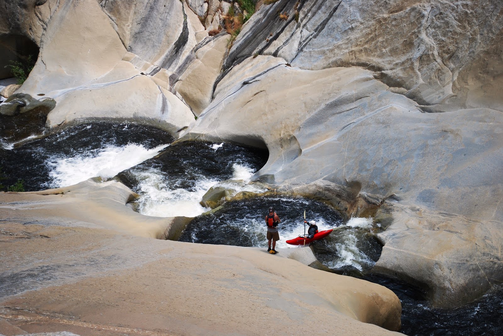
After spending five days in the Kern drainage (see previous post), on our sixth day in California we broke camp early and began driving north. It took a bit longer than we expected, but by mid afternoon we met up with another truckload of southeasters in the town of Three Rivers to discuss our next move. Almost everything in the Kaweah drainage was still too high, but Greg Garrard and Chas Lemley suggested that we join them for a run on the Shatner Ranch section of the South Fork of the Kaweah. They had made the run the previous day and assured us would still be at a good level. The S.F. of the Kaweah wasn’t really on our radar, but with the opportunity to join up with a solid crew who had done the run the day before, we quickly agreed and followed Greg to the put-in. A look downstream from the bridge at the put-in gave us a preview of the continuous boogie water that would characterize the entire run. [To get an idea of just how continuous, check out some helmet cam footage shot by Austin Nickell HERE]


If any short stretch of the Shatner Ranch run ended in a pool, the run would be considered easy class IV. However, due to the continuous nature and non stop gradient, any mistakes would be quickly complicated and with no pools throughout the run, recovery could be difficult. This was demonstrated about a third of the way into the run when Leigh and John got tangled up and ended up taking a tandem swim. Thanks to quick moves by Greg, both swimmers got to shore pretty quickly, but the gear recovery took a bit more time. Luckily all was recovered and we proceeded downstream with a more cautious approach. Under different circumstances this might have been one of my favorite rivers of the trip. However, my strained shoulder was becoming more painful with every left brace and when the take-out bridge came into view, rather than wishing for another run, I was relieved to be done. Our combined crews then proceeded into Sequoia National Park to camp for the night and position ourselves for our next objective, Clover Creek.


The next morning we packed up camp and started gaining elevation as we drove up further into Sequoia National Park towards Clover Creek. As we moved to higher elevation, the parks namesake giant sequoias began to tower overhead. We parked and made the short walk to the General Sherman tree. While not the oldest or tallest tree, the General Sherman tree is the largest tree on earth (based on the volume of its trunk). One of the limbs on the massive tree is seven feet in diameter. As we made our way back to our vehicles I couldn’t help, but to think that walking through a grove of giant sequoias, some of which are thousands of years old, is a nice reminder of what our place should be in the natural world.


Clover Creek is high in the Kaweah Drainage in Sequoia National Park and is actually a tributary of the Marble Fork of the Kaweah. I wouldn’t call it a legitimate creek run, it is more of a hike and huck adventure in a beautiful setting. The runnable section of Clover Creek is really a long series of cascades that make up a single impressive granite slide. A short hike down the trail from the parking lot led us to the creek. We continued to hike upstream on river right, first reaching the bottom of the slides and then continuing upstream to what seemed like the logical place to put-in. We dropped our boats and then hiked the length of the slide a couple times, scouting and planning our runs.


Greg was the first to make a go of it and then the rest of us made our runs one at a time while the others would position themselves at different points along the slide. Some in the group hiked back to the top for multiple runs on this impressive series of slides. I couldn’t resist running it once, but considering the state of my shoulder I didn’t want to press my luck. Between the smooth granite, beautiful cascades, and wildflowers lining the banks I just focused on shooting more and more photos of this special place. Despite the fact that we did relatively little boating that day, in retrospect it was one of my favorite parts of the trip. Seeing giant sequoias for the first time, running an awesome slide in an idyllic setting… what more could anyone ask for.


After leaving Clover Creek we made our way out of Sequoia National Park and back to the town of Three Rivers. Our combined crews spent one final night camping together, sharing a few beers, and reviewing the pictures and video from the day. The following morning our two groups we parted ways, each with different objectives in mind. They were still holding out hope that the forks of the Kaweah or South Silver might come down into the runnable range, while we had our sights set on Downieville, California and the easy logistics provided by Pauley and Lavezzola creeks.


Until Next Time...

-adam


kayak session

Friday, September 16, 2011

Decision Time On Dry Meadow Creek - a.k.a. Dry Meadow Creek The Hard Way


After four days of running laps on Brush Creek, the plan for our fifth day in California was to check out the Teacups of Dry Meadow Creek. We had decided that we would simplify logistics by only using one car and hiking to and from the Teacups (rather than portaging our way to the Kern River and paddling out). The hike was supposedly only around one and a half miles each way, which just didn’t seem like that much. We were planning to run the Upper N.F. of the Kaweah a few days later (which would require a four mile hike) so a three mile hike seemed like it would be a good warm-up.


I’d like to blame someone else for this plan, but it was my idea... and let me assure you that it did nothing to “simplify logistics”. What we didn’t know about the hike was that a lot of it was off-trail and it ended up requiring some unanticipated reconnaissance hiking in addition to the mileage to and from the Teacups. The hike was also mostly through an area that had previously burned in a forest fire, which resulted in crossing over many downed trees along the way. Needless to say, it was harder and took longer than any of us had anticipated.


We parked John’s trusty Subie at what we guesstimated to be the correct pull-off on the side of the road. The hike started up a steep four-wheel-drive trail which quickly turned into a faint walking trail and then no trail at all. We found ourselves following a dry wash downhill and out into a dry meadow, which seemed promising, given the name of our destination. It also seemed very likely that the dry wash we were in would lead us to Dry Meadow Creek, but we really didn’t know. We kept moving, taking breaks periodically and sometimes taking turns going ahead (sans boats) to scout out the best route. We were pretty sure we were going towards the creek, but just hoping we would come out at the Teacups or at least upstream of them on Dry Meadow Creek and not at the Kern River.


Eventually we could see that our route was going to intersect a larger drainage ahead. Our hopes were raised and as we got closer and could see that the drainage was not large enough to be the Kern River itself. First we heard the running water and shortly thereafter Dry Meadow Creek came into view. Relieved to have found the creek, we cooled off in the refreshing water and then began to work our way downstream. We paddled a few small slides and rapids and completed a couple of short portages. Before too long, we found ourselves looking at one of the most impressive geologic features I have ever seen.


The first Teacup of Dry Meadow Creek ends in a dead end pool where almost all the water goes under a bedrock land bridge a mere two feet wide. The next six drops range in height between eight and twenty five feet and land in impressive round potholes, some of which were twenty or more feet deep and had slightly overhang walls. After the runnable Teacups, the next drop is somewhere around 50-60 feet tall and lands onto rocks and the drop following that looks even larger and disappears into a crack. Certainly not a place to miss the take-out and as we looked at it I couldn’t help, but think of the infamous accident and impressive rescue that took place here when someone accidently missed the takeout.


For a while we all scampered about, just in awe of the amazing sight before us. At first we were just taking it all in, but soon the scouting began in earnest. The six Teacups are run as a set and accessing them individually isn’t really possible (at least not without some rope work). None of the six drops were especially hard or dangerous, but the third one immediately became the focus of our attention. The aptly named Superfreak, had an angled, pinch in the entrance and then about a twenty-foot freefall. It also had a reputation for making boaters land on their heads. I couldn’t help, but think to myself that I would almost rather land upside down than land in a big left brace on my already strained left shoulder.


On either side of the river, the smooth, bowl-shaped granite severely limited our mobility while scouting and would also limit options for setting safety. Any trouble that required extracting a person or boat from any of the first four teacups would be very difficult. Adding to our thought process was the fact that we only had two 65 foot throw ropes. We had assumed that we would paddle in pairs with the other two members of the group on the bank with ropes. It seemed logical at the car, but looking at the Teacups in person made me wish we had a long length of static rope, or at least a couple longer throw ropes.


Standing there, I couldn’t believe I was even considering not running the Teacups. I had dreamt of running them for well over a decade and had paid the price of admission by completing the hike. However, the more I scouted the more I worried that the third drop was going to make me land in a big left brace and destroy my shoulder and the rest of our trip. Even if it didn’t do further damage, I imagined being upside down against one of those overhanging walls and trying to roll up with my strained shoulder. A swim at the base of the third drop would require some serious assistance from the rest of the group and an injury would require a rescue that would be extremely difficult considering our lack of adequate gear.


Ultimately it wasn’t something I was willing to risk in such a remote setting or something I wanted to risk burdening the rest of the group with if something went wrong. I announced to everyone that I was not going to run it, but assured them I would do whatever was needed to support them if they choose to run it. It turned out Leigh and John also had second thoughts and in the end it was only Terran who made the run. He had great lines on all six drops and overall made it look quite easy. He also managed to keep it upright on Superfreak, but did land in a big brace, making me feel at least partially validated in my assessment while scouting.


Despite Terrans great lines I didn’t find myself second guessing my decision. After his run, Leigh conducted some reconnaissance hiking to scout out a possible quicker route back to the car, but eventually returned and explained that the trail we thought we had seen just disappeared after a short distance. We decided we would just have to go out the same way we came in and we began the hike with about as much enthusiasm as could be expected. When we finally got to the car we were all extremely dehydrated and beaten down by a long day of carrying boats and very little boating.


Dry Meadow Creek is not as high on my California wish list as it once was. However, I do think that I will go back there at some point in the future. The Teacups are simply too unique and beautiful to not go back and seeing them in person only solidifies the mystique that surrounds them in my imagination. After all, now that I know about the logistical challenges, next time will be much easier. In retrospect, we should have set shuttle on the Kern River and accessed the Teacups by boating and portaging our way from higher in the watershed. However, you live and you learn and I’ve got no regrets. Everyone needs a humbling day of wondering around in the wilderness now and then… and I was overdue.


Until Next Time...

-adam


kayak session

Friday, September 2, 2011

California Softcore


In early June I realized that I was going to have time for a little western adventure this summer. Having paddled a good bit in Colorado in the past, California was at the forefront of my mind. California in summer is on every creekboaters wish list and after years of missing out, I finally got my first taste this year. With all the hardcore trip reports from California lately, it kinda has me feeling like a slacker. Our quickie trip to California this summer was not hardcore. It was, however, fun and picturesque and certainly wetted my appetite for future California adventures.


The whole trip came together at the last minute. When I mentioned to John Kern that I had a window of time to make a trip happen, he was immediately as ready and excited for California as I was. A short time later Leigh Knudsen and Terran Viehe also decided to join the trip. The plan began to come together. John and I would drive across the country with everyone’s gear while Leigh and Terran would fly into Reno, rent a car to come meet us, and all of us would have eight days together to paddle in a region of the country that would be new to us all.


John and I wanted to give ourselves a time-cushion to make our cross country drive. We wanted to allow ourselves enough time that that if we had any car trouble etc., we would have time to deal with it and still be in California in time to meet Leigh and Terran. If everything went perfectly on our cross country drive, we would arrive a few days ahead of everyone else and get a few extra days of bonus boating.


There are only about two turns between Chattanooga, Tennessee and the state of California… and only a few more to get us to Kernville. Our entire drive went extremely smoothly and we arrived three days before we would be joined by Terran and Leigh. After a brief stop in Kernville we headed immediately headed up to Brush Creek to shake off the drive with some California rock sledding.


All told, John and I spent four days doing laps on Brush Creek with Terran and Leigh joining us for the final day. The water levels were fairly low (mostly in the 1.5-2 range) throughout our stay, but the smooth bedrock and constant slides kept smiles on our faces during every run. We caught a lucky break in the declining water levels when afternoon thunderstorms on our last two days there brought the level up to around 2.5 for a few hours late each afternoon.


It’s hard to beat Brush Creek’s easy logistics: free camping at the takeout, a short shuttle, and good food/beer a short drive away at the Kern River Brewing Company. Unfortunately I also strained my left shoulder on the third day. It was an injury that I kept trying to ignore, but for the rest of the trip it would hang in the back of my mind at every put-in, every scout, and every left stroke/brace. Eventually I had to just admit that nothing would help my shoulder until it got some rest, so I sat out the final three days of our trip, but I’ll save that story for another time.


Until Next Time...

-adam goshorn


kayak session