All photos by Adam Goshorn unless otherwise noted.

After our four-day, self-supported run of Hells Canyon in Idaho, the second phase of our trip was going to be another self-support run, but this time we would be joined by my brother for a river on the easier end of the spectrum. My brother had been learning to kayak over the past few summers and was very interested in doing his first self-supported river. Wanting him to have a low-stress run for his first overnighter, early in the spring we had applied for permits for the Desolation Canyon section of the Green River in northern Utah and the Sand Island to Clay Hills section of the San Juan River in southern Utah Idaho , my brother called me to say a cancelation opened up a launch on the San Juan Salt Lake City and when we would meet my brother to run the San Juan

From the take-out of Hells Canyon, Matt, John, and I drove due south, crossing into Utah and checking into a hotel in Salt Lake City. Making sure John was able to catch his flight home to Tennessee (the next morning) was the top of our agenda, but showers and a good night’s sleep was certainly a nice bonus. The next morning John took a shuttle to the airport while Matt and I took advantage of the hotel and slept in. After all, we had almost a week before our rendezvous to run the San Juan. We had discussed using this unanticipated extra time between self-support trips to swing through Colorado and do some creeking. However, the dismal snowpack left us with almost no options and we didn’t want to spend a bunch of gas money to paddle the one or two things that still had water.

Instead, we decided to try to take a more direct route towards the San Juan and see what we could find to amuse ourselves along to way. As we headed on our southern trajectory we ended we spotting whitewater right by the highway. From high above on the road we could see some boulder gardens and what looked like a runnable flow. Heading into the next town we sat outside a hotel to score some free internet and see what river we had seen from the road. Apparently there are multiple sections of Price River and the section that caught our eye was the middle section of Price River Canyon. The online description was rather vague, but it did give suggested access points for the best 8-mile section. It was late in the afternoon so we headed back up into Price River Canyon to camp at a BLM campground, planning to check out the run the following day. That night white ash settled on our tents and the surrounding area from the Price Canyon Fire located not far away.
Below: Smoke from the Price Canyon Fire.

The next morning we paddled the recommended 8-mile section and what we found was a fun run consisting of mostly class III-IV rapids with a few very continuous sections that might approach class IV+. It was actually quite fun, but unfortunately the river is sandwiched between the highway and the railroad. Almost every rock in the riverbed was a result of the construction of these two projects on either side, resulting in extremely sharp rock that simply shreds boats. Had the rocks been smooth I think we would have camped there for days and done laps on this fun little run. However, after a single run our boats looked terrible and neither of us was willing to abuse them again with a second lap.
While hitchhiking shuttle for Price River Canyon a nice family pulled over and rolled down their window. They had only stopped because they thought I was having car trouble (I was, after all, parked on the shoulder of a four-lane highway), but upon explaining that we were kayaking they agreed to give me a ride. They instructed their two children in the back seat to slide over and I climbed in next to them, immediately filling their car with the stench of unwashed paddling gear. I could smell myself, so I’m sure they were gagging, but they didn’t mention it as we rode up to the put-in. Along the way they told me about a great petroglyph site call Nine Mile Canyon, not far away. Matt and I decided to spend the following day checking it out.
Below: Matt hiking in Nine Mile Canyon

Below: Petroglyphs in Nine Mile Canyon

As we continued south towards our eventual goal of meeting my brother to paddle the San Juan River, we spent a few days around Moab, Utah checking out Canyonlands National Park and Arches National Park. The intense summer heat made it unbearable to do a lot of hiking, but neither of us had ever visited either park before and we made the best of it, checking out all the spots that had short hikes from the road.
Below: Canyonlands National Park

Below: Arches National Park

Below: Matt in Arches NP

Our last day in Moab we spent the afternoon at a laundry mat, giving our clothes a much needed freshening. The next morning we continued further south, eventually finding our way to Bluff, Utah and camping at the BLM campground at the put-in for the San Juan. We still had another day before my brother’s arrival, so we spent the next day making sure we could find the take-out and seeing the limited sites around Bluff. We also found great food at the Twin Rocks Café and I would highly recommend it to anyone in the area. We liked it so much we found ourselves eating there several times before and after our run of the San Juan.
Below: The Twin Rocks Café and Trading Post, photo by Vitaly Prikhodko

Below: Matt checking out the view along the shuttle route, photo by Vitaly Prikhodko

My brother flew from Knoxville Tennessee to Albuquerque New Mexico, rented a car, and then drove to Bluff to meet us. Doing so prevented us from having to pick him up at the airport and having the rental care meant we could drive our own shuttle and not pay for shuttle service. We spent the next day setting shuttle and also stopped to visit Natural Bridges National Monument (which was on the shuttle route on the way back to Bluff) and then ate another great dinner at the Twin Rocks Cafe. After dinner we checked out a large petroglyph panel near the BLM campground at the put-in and spent another night camping there as well.
Below: Vitaly looking back down at the crazy shuttle road we had just driven.

Below: Natural Bridges National Monument

Yup, those little dots are people under one of the massive natural bridges.

Finally, after a week of killing time and slowly making our way to Bluff, the day of our scheduled launch arrived. Matt and I were happy the waiting game was over and my brother was extra excited to launch on his first overnighter. After our orientation with the river ranger, we launched mid morning and knocked out around 31 miles on the first day. Even with the high mileage we put in, we still stopped for several long breaks to check out the Butler Wash Petroglyphs and the River House, an awesome cliff dwelling a couple hundred yards off the river.
Below: Petroglyphs at Butler Wash

Below: Vitaly enjoying borrowing my Large Fusion.
Below: The River House, photo by Vitaly Prikhodko

Below: Matt and I floating past the town of Mexican Hat

Our second day on the San Juan
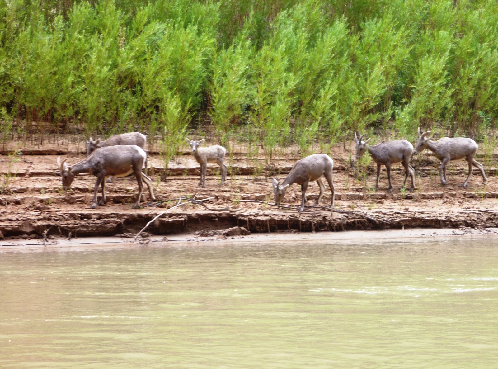
Below: A large ram drinking from the San Jan River

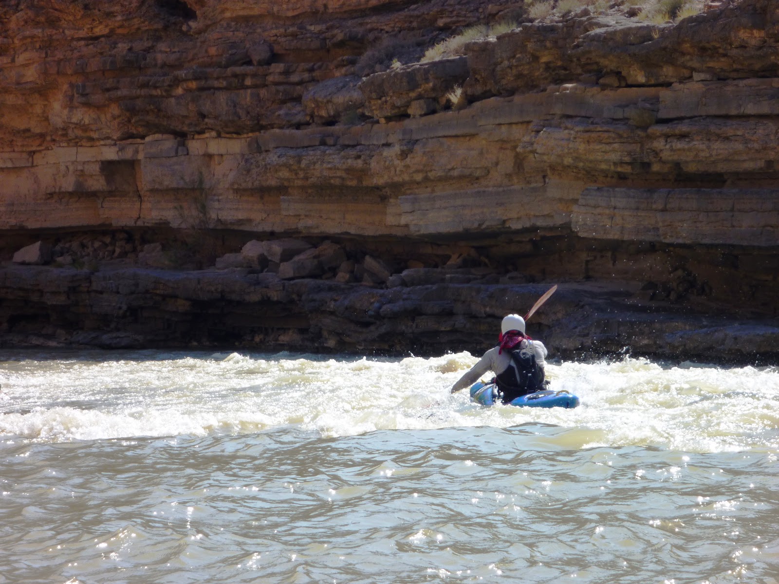
Below: Matt running Government Rapid, photo by Vitaly Prikhodko

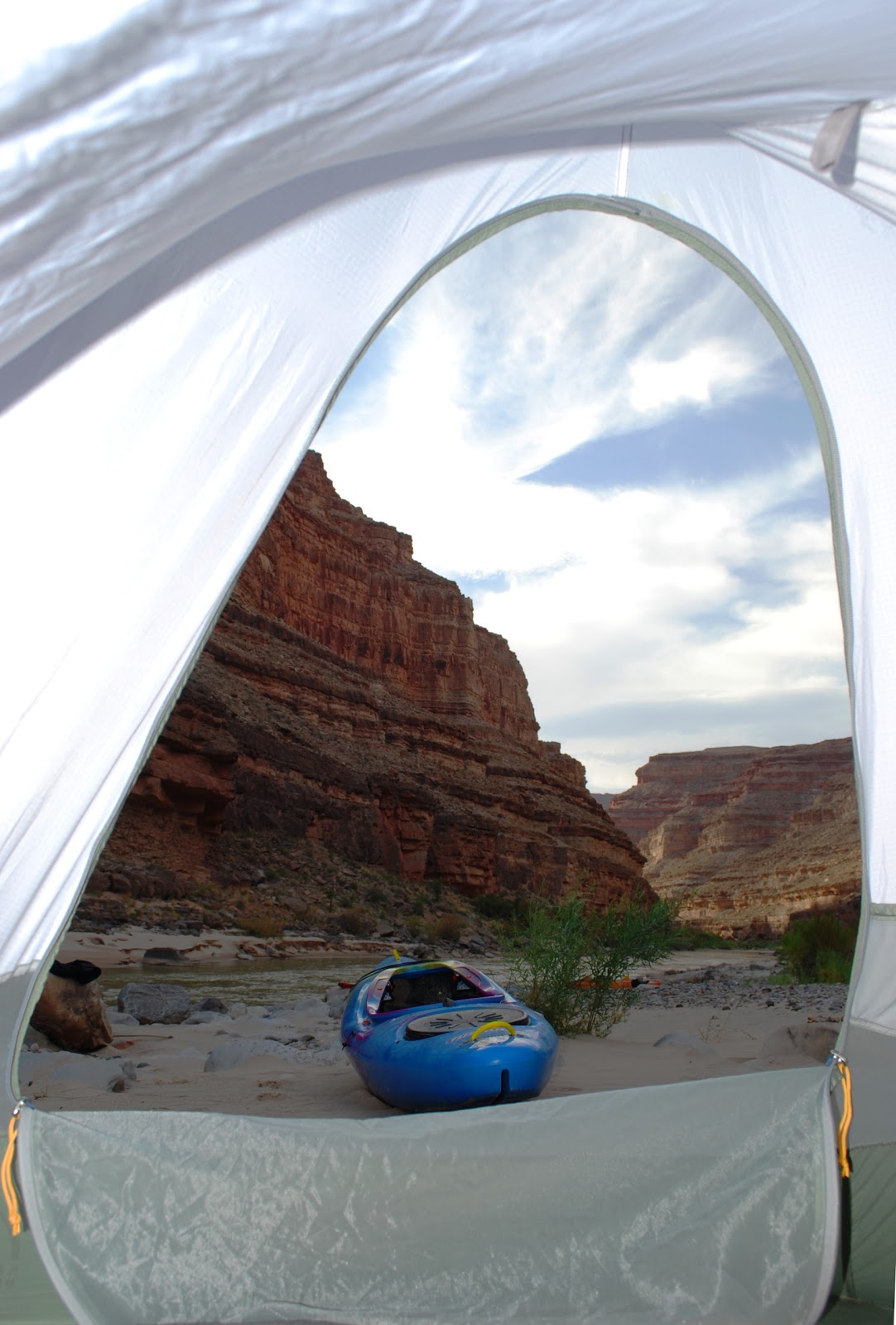
Below: The view from my tent on the morning of Day 3
The total run from Sand Island to Clay Hills on the San Juan Lake Powell

Below: Pushing through the flats in the backwaters of Lake Powell

We had originally planned to paddle the 83 miles down the San Juan Mesa Verde National Park in Colorado San Juan Mesa Verde National Park before driving to Albuquerque
Below: Mesa Verde National Park

Below: Mesa Verde National Park

From Albuquerque, the three of us rotated shifts driving and drove straight through to Knoxville in about 22 hours, dropped my brother at his house, and continued back home to Alabama. It had been three weeks since Matt, John, and I had first hit the road and in that time we had driven through a dozen states, paddled hundreds of miles, visited four National Parks, and seen a huge swath of the country. Once recovered from the intense drive home, we immediately began to discuss what are next adventure might be, the need for travel continuing to nag us every day we are at home.
Below: Vitaly, Matt, and I, photo by Vitaly Prikhodko

Until next time…
-Adam Goshorn
Below: A raft passing us at Butler Wash.

Below: One of many groups of Bighorn Sheep we spotted along the river, photo by Vitaly Prikhodko