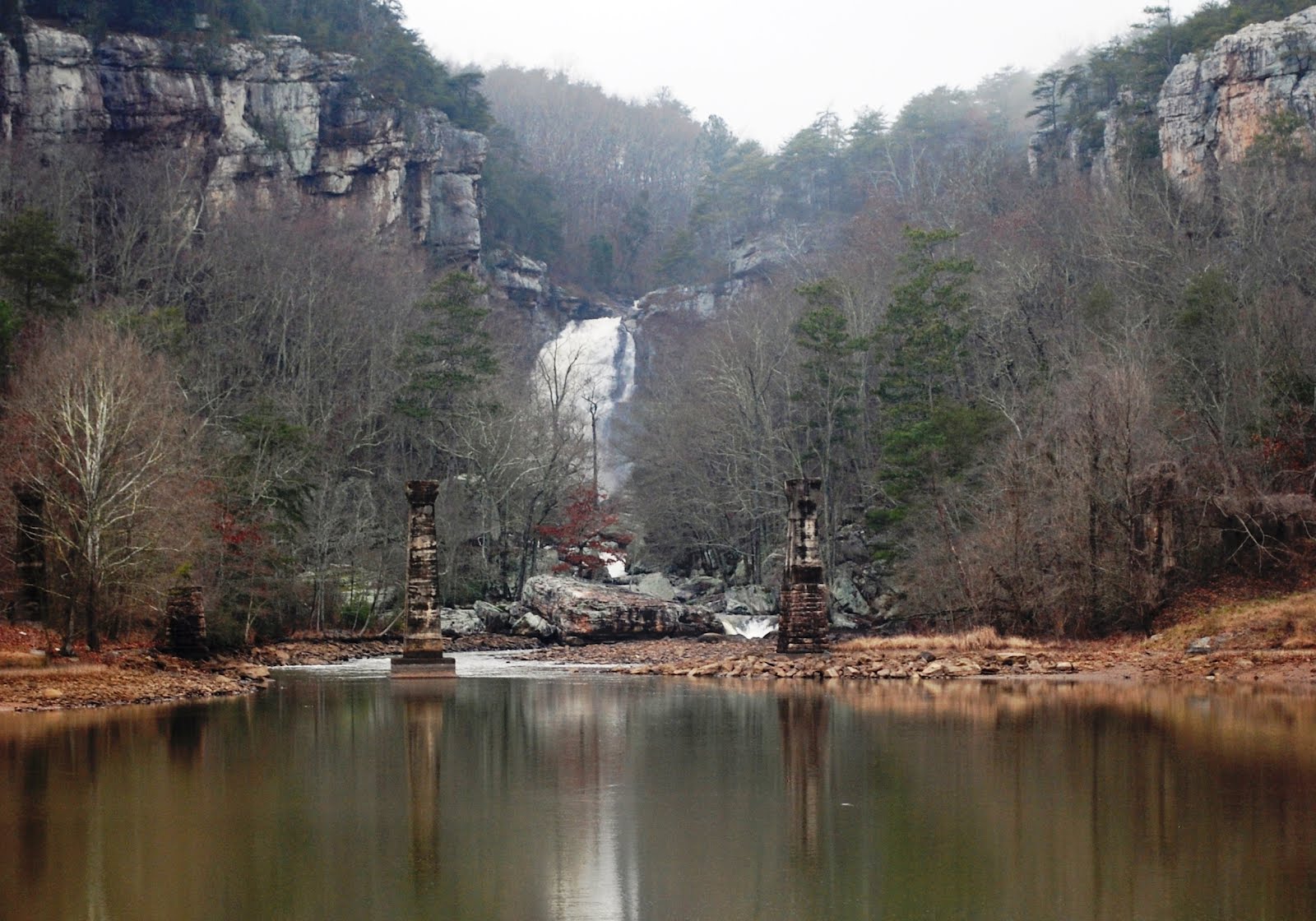
Below: view of Yellow Creek Falls from the take-out, photo by Adam Goshorn
Yellow Creek flows east off of Lookout Mountain a short distance south of the ultra-classic Johnnies Creek. Historically, Yellow Creek was also tributary of Little River (just like Johnnies Creek), but in modern times it flows into Weiss Lake, as does Little River. Who knows what historic Yellow Creek rapids might be buried beneath the waters of Lake Weiss, but what remains above the lake is a short, steep section of creek that involves several beautiful portages... and some runnable rapids as well.
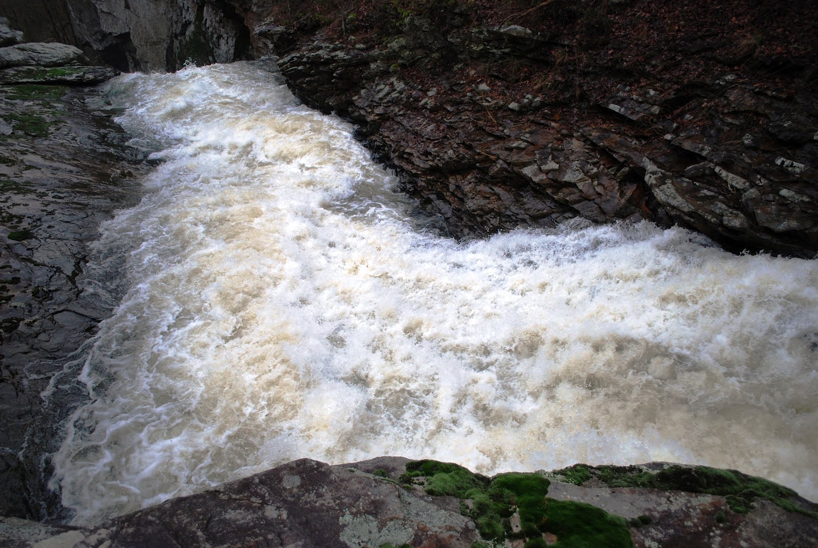
Below: water level at the put-in bridge, photo by Adam Goshorn

After the short drive to the put-in, we hurriedly dressed out, hoping to put on before encountering any local landowners who might question our actions. We were spotted by a couple of passing cars, but they seemed uninterested in us as we accessed the creek. We quickly put on, ran the first rapid, and paddled out of site of the road, glad to have the potential human conflict behind us and able to focus on the creek in front of us. The first few rapids were series of small ledges with easily discernable lines in the main flow of the creek.
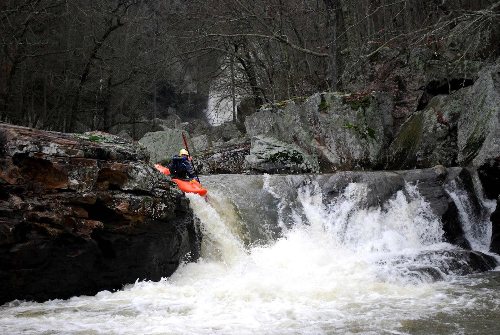
Below: Ben runs one of the early rapids, photo by Adam Goshorn

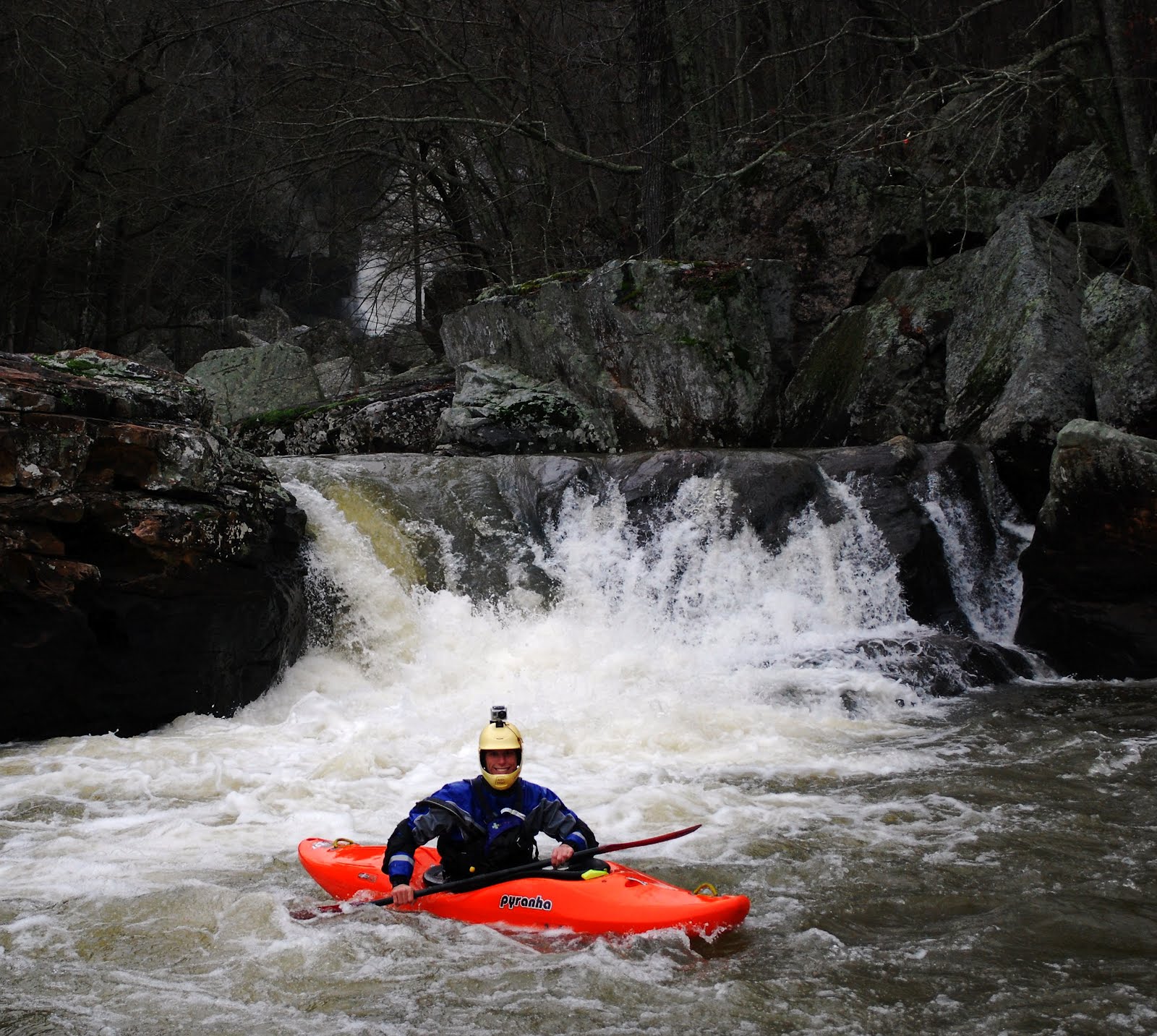
Below: Ben runs the rapid above The Crack, photo by Adam Goshorn

After several easy ledge rapids we found ourselves scouting and portaging two rapids in a row. Both rapids were somewhat strange and different than most of the other geologic features found on other creeks on Lookout Mountain. The first was a two-foot wide, bedrock crack that was in the middle of the streambed and swallowed the entire volume of the creek. It looked possible to run it, but it was also barely a boat-width wide and undercut on both sides. We choose to take the an easy portage over the exposed bedrock on river left.
Below: Ben scouts The Crack, photo by Adam Goshorn

After making a quick portage of The Crack, we arrived at one of the main reasons we were so intrigued by Yellow Creek in the first place, V-Falls. We had heard of an unrun falls that was over 20-feet tall and we had wanted to see it for ourselves. Standing there in person, two things were quite clear. First, it was obvious why no one had previous run this falls, despite the deep pool it had a tricky shaped lip and undercuts on both sides at the bottom. Secondly, it seems clear to both of us that with a higher water level, this drop will surely see a kayak descent. After a long scouting session we both decided to portage again and found our way around some large boulders on the left and scrambled down a steep gully back to river level.
Below: Ben Scouts V-Falls, photo by Adam Goshorn

After V-Falls, we were able to boat-scout several easier rapids in a row. It was nice to make such easy downstream progress, but we knew we had to be getting close to Yellow Creek Falls, a massive drop requiring a mandatory portage. We ran one more easier rapid and caught a eddy on river left above what seemed to be a dramatic increase in gradient. Upon exiting our boats it was immediately clear we were at the main attraction. In front of us was a sliding drop that started out steep, leveled out briefly, and then fell off the face of the earth!
Below: the slide that leads into Yellow Creek Falls, photo by Ben Bernhard

Below: the lip of Yellow Creek Falls, photo by Adam Goshorn
Below: Ben at the lip of Yellow Creek Falls, photo by Adam Goshorn

Below: Yellow Creek Falls from the portage route, photo by Adam Goshorn

The first step to portaging Yellow Creek Falls involved leaving our boats behind while we walked along the top of the cliff seeking a place that might allow us to descend. After a short time we found an acceptable route and retrieved our boats from the lip of the falls. In one place the portage route involved removing our PFDs to pass through a narrow crack in the rock. In a couple of places we also used throw ropes to lower boats down broken sections of cliff. The terrain was steep, but we both agreed that now that we know where to go, the next time we paddle Yellow Creek we could easily portage in half as much time.
Below: Ben portaging Yellow Creek Falls, photo by Adam Goshorn

Below: Yellow Creek Falls from below, photo by Ben Bernhard

Below: Adam finishing the Yellow Creek Falls portage, photo by Ben Bernhard

At the water level we had for our descent of Yellow Creek, the first two rapids below the falls were an ugly, sieve infested pile of boulders, but it seemed that runnable routes might be possible at higher water. The third and forth rapids after the falls, which were coincidently the last two rapids before Yellow Creek’s confluence with Weiss Lake, both had runnable lines and were incredibly picturesque as Ben made his way down the rapids with Yellow Creek Falls visible in the background.
Below: Ben on the 2nd to last drop, photo by Adam Goshorn

Below: Ben on the last drop into the lake, photo by Adam Goshorn
Below: Ben on the last drop into the lake, photo by Adam Goshorn

Below: Ben on the last drop into the lake, photo by Adam Goshorn
After the short paddle across the lake, Ben and I found ourselves back at the truck having completed another great day of exploring close to home. The take-out for Yellow Creek is a mere 30 minutes from my house, yet I had never even seen the falls, much less paddled the creek. After paddling Hurricane Creek and Yellow Creek on consecutive days, my interest has become more peeked for further exploration into the unknown parts Alabama. My topo maps keep seeing more and more notations and markings, as more and more creeks are calling to be explored… perhaps if it would rain inches every Friday, every weekend could be as productive as this one was!
Until Next Time,
-adam goshorn
Below: Adam paddling out across the lake, photo by Ben Bernhard

| kayak session |


