Friday, March 30, 2012

Unknown Alabama - Part II: Yellow Creek

The day after our exploration of Hurricane Creek there was still plenty of water on Lookout Mountain. Ben Bernhard and I had been talking about making a run on Yellow Creek for quite some time, so this seemed like the perfect opportunity. It was not a first descent, we knew that it had been run before, but not often and not by many and it was the mystery of this rarely-run creek that called to us. While setting shuttle at the take-out we couldn’t help but gaze across the lake at Yellow Creek’s confluence with Weiss Lake and the massive Yellow Creek Falls visible through the trees. We didn’t know much about the rest of the creek, but it seems obvious that we would be spending the day in one of the most beautiful mini-canyons in Alabama.

Below: view of Yellow Creek Falls from the take-out, photo by Adam Goshorn
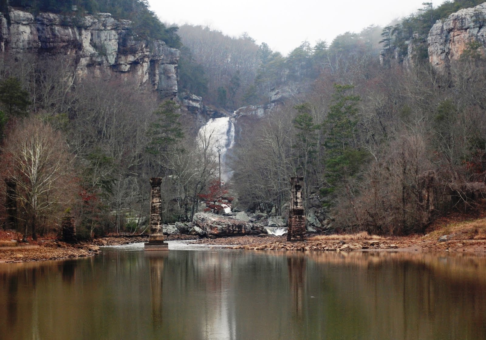

Yellow Creek flows east off of Lookout Mountain a short distance south of the ultra-classic Johnnies Creek. Historically, Yellow Creek was also tributary of Little River (just like Johnnies Creek), but in modern times it flows into Weiss Lake, as does Little River. Who knows what historic Yellow Creek rapids might be buried beneath the waters of Lake Weiss, but what remains above the lake is a short, steep section of creek that involves several beautiful portages... and some runnable rapids as well.

Below: water level at the put-in bridge, photo by Adam Goshorn


After the short drive to the put-in, we hurriedly dressed out, hoping to put on before encountering any local landowners who might question our actions. We were spotted by a couple of passing cars, but they seemed uninterested in us as we accessed the creek. We quickly put on, ran the first rapid, and paddled out of site of the road, glad to have the potential human conflict behind us and able to focus on the creek in front of us. The first few rapids were series of small ledges with easily discernable lines in the main flow of the creek.

Below: Ben runs one of the early rapids, photo by Adam Goshorn


Below: Ben runs the rapid above The Crack, photo by Adam Goshorn


After several easy ledge rapids we found ourselves scouting and portaging two rapids in a row. Both rapids were somewhat strange and different than most of the other geologic features found on other creeks on Lookout Mountain. The first was a two-foot wide, bedrock crack that was in the middle of the streambed and swallowed the entire volume of the creek. It looked possible to run it, but it was also barely a boat-width wide and undercut on both sides. We choose to take the an easy portage over the exposed bedrock on river left.

Below: Ben scouts The Crack, photo by Adam Goshorn


After making a quick portage of The Crack, we arrived at one of the main reasons we were so intrigued by Yellow Creek in the first place, V-Falls. We had heard of an unrun falls that was over 20-feet tall and we had wanted to see it for ourselves. Standing there in person, two things were quite clear. First, it was obvious why no one had previous run this falls, despite the deep pool it had a tricky shaped lip and undercuts on both sides at the bottom. Secondly, it seems clear to both of us that with a higher water level, this drop will surely see a kayak descent. After a long scouting session we both decided to portage again and found our way around some large boulders on the left and scrambled down a steep gully back to river level.

Below: Ben Scouts V-Falls, photo by Adam Goshorn


After V-Falls, we were able to boat-scout several easier rapids in a row. It was nice to make such easy downstream progress, but we knew we had to be getting close to Yellow Creek Falls, a massive drop requiring a mandatory portage. We ran one more easier rapid and caught a eddy on river left above what seemed to be a dramatic increase in gradient. Upon exiting our boats it was immediately clear we were at the main attraction. In front of us was a sliding drop that started out steep, leveled out briefly, and then fell off the face of the earth!

Below: the slide that leads into Yellow Creek Falls, photo by Ben Bernhard


Below: the lip of Yellow Creek Falls, photo by Adam Goshorn
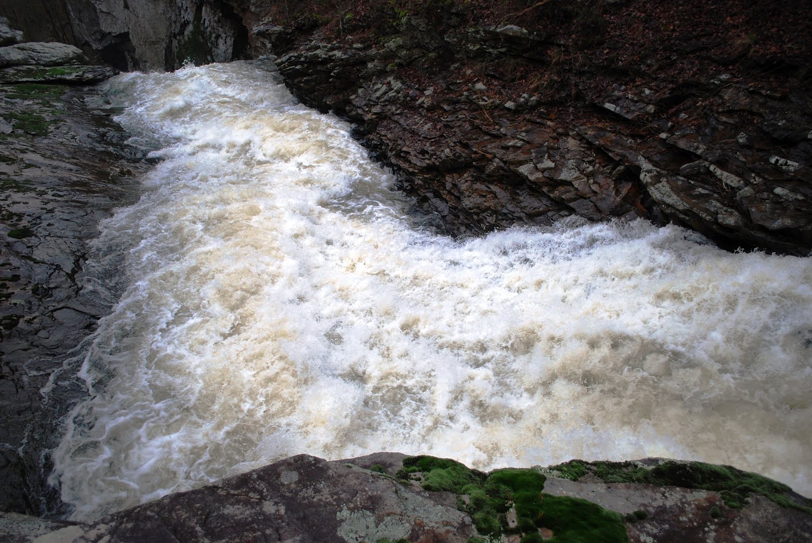

Below: Ben at the lip of Yellow Creek Falls, photo by Adam Goshorn


Below: Yellow Creek Falls from the portage route, photo by Adam Goshorn


The first step to portaging Yellow Creek Falls involved leaving our boats behind while we walked along the top of the cliff seeking a place that might allow us to descend. After a short time we found an acceptable route and retrieved our boats from the lip of the falls. In one place the portage route involved removing our PFDs to pass through a narrow crack in the rock. In a couple of places we also used throw ropes to lower boats down broken sections of cliff. The terrain was steep, but we both agreed that now that we know where to go, the next time we paddle Yellow Creek we could easily portage in half as much time.

Below: Ben portaging Yellow Creek Falls, photo by Adam Goshorn


Below: Yellow Creek Falls from below, photo by Ben Bernhard


Below: Adam finishing the Yellow Creek Falls portage, photo by Ben Bernhard


At the water level we had for our descent of Yellow Creek, the first two rapids below the falls were an ugly, sieve infested pile of boulders, but it seemed that runnable routes might be possible at higher water. The third and forth rapids after the falls, which were coincidently the last two rapids before Yellow Creek’s confluence with Weiss Lake, both had runnable lines and were incredibly picturesque as Ben made his way down the rapids with Yellow Creek Falls visible in the background.

Below: Ben on the 2nd to last drop, photo by Adam Goshorn


Below: Ben on the last drop into the lake, photo by Adam Goshorn
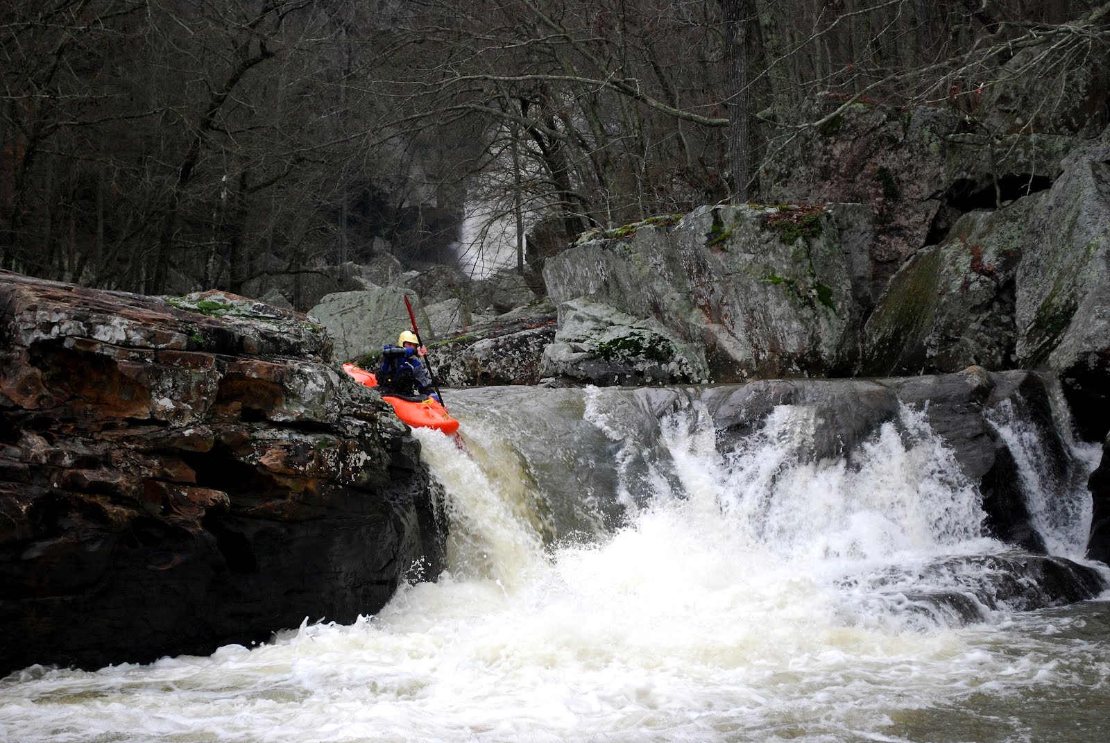

Below: Ben on the last drop into the lake, photo by Adam Goshorn


Below: Ben on the last drop into the lake, photo by Adam Goshorn
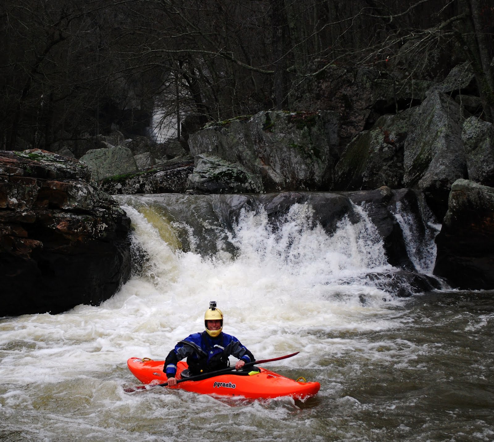

After the short paddle across the lake, Ben and I found ourselves back at the truck having completed another great day of exploring close to home. The take-out for Yellow Creek is a mere 30 minutes from my house, yet I had never even seen the falls, much less paddled the creek. After paddling Hurricane Creek and Yellow Creek on consecutive days, my interest has become more peeked for further exploration into the unknown parts Alabama. My topo maps keep seeing more and more notations and markings, as more and more creeks are calling to be explored… perhaps if it would rain inches every Friday, every weekend could be as productive as this one was!

Until Next Time,

-adam goshorn

Below: Adam paddling out across the lake, photo by Ben Bernhard


kayak session

Unknown Alabama - Part I: Hurricane Creek

The winter is always a great time to be a paddler in Alabama and so far, the winter of 2011-2012 has delivered! Saturday morning January 21st, at the end of rainy week, another band of thunderstorms rolled across Lookout Mountain at just the right time. Everything in the area was already primed from the rain earlier in the week and this final band of storms brought locally heavy rainfall on top of already saturated soil. With so much water on the mountain, it was the perfect time for some local exploring!


Just after the rain stopped, Matt Jones, Eric Allsup, Chuck Holbrook, and I met at Blue Hole, just upstream of Little River Falls. They all seemed a little skeptical of my idea to explore Hurricane Creek (a small tributary of Little River), but they also shared my attitude that any creek is worth doing once, so away we went. Upon reaching the put-in on Oak Hill Road near Fischer AL the water was nice and brown and the level looked acceptable. We quickly launched on the upstream side of the bridge and one by one ran the four-foot ledge on the downstream side of the bridge. There were smiles all around and I couldn’t help, but feeling that giddy excitement that I feel every time I am about to paddle a new run. I feel it every time I paddle a run for the first time, but especially in a situation when we have no idea what is downstream!


We knew that this run was not extremely steep and we also knew the majority of the gradient was concentrated in middle of the run. As expected, after the initial bedrock ledge, the first part of the run was mostly battling strainers in class II. We pulled ourselves over, ducked under, and beat our way though a multitude of brush and trees that blocked our path. Eventually we could see a horizon line and an abrupt increase in gradient. We had found what we came for… it was time for a scout!


As the topo map foretold, the majority of the gradient was concentrated in the middle of the run and started out with a stack of five large rapids. The first of the set was a low-angle slide which led into a fun, nine-foot boof. We took our turns one by one off the first drop, but unfortunately we had to leave the next three drops unrun due to unavoidable hazards. The second and fourth of set were blocked with large logs and the third drop clearly needed a higher water level to avoid a bad sieve on the left.


The final of the set of five was really a three stage affair with a large, but avoidable, sieve on the left after the first part of the rapid. Eric and I portaged the first two-thirds of the rapid, putting in below the second drop to run the last ledge. Matt and Chuck elected to slide into the second drop below the sieve and off a low volume boof. With our group reunited at the bottom we made good time was we finished the run out to the confluence with the Little River and on downstream to our vehicles parked at Blue Hole.


Hurricane Creek is only a small line on the map, but one I had wondered about for a few years. It was great to finally check it out and we all came away presently surprised with what we found. It will never be a classic run in an area with so many high quality runs, but when there is an abundance of water on Lookout Mountain it does provide another option for those looking to get off the beaten path. Its proximity alone makes me sure that I will return for another descent. The put-in is a mere five-minute drive from my house and after all, there are still three more rapids that are yet to be fully run!

Until Next Time…

-adam

kayak session

Wednesday, February 1, 2012

Mexico 2011: Budget for Life!

Below: Steve on the Rio Valles, photo by Adam Goshorn


Below: Adam on the Rio Santa Maria, photo by Steve Krajewski


Since my first trip to the Huasteca region of Mexico in 2005, I have returned almost ever winter for 2-3 weeks to revisit my favorite rivers in the area and explore new ones as well. There is an abundance of rivers in the region with a variety of options depending on water levels. Most recently, Steve Krajewski, Mark Newton, and I drove south from Alabama to spend a couple of weeks enjoying the warm waters and sunshine provided by the Huasteca region in December of 2011. Despite lower than normal water levels, we had good weather and an awesome time paddling many of the classic and a few not-so-classic rivers in the area.

Below: Mark on the Rio Verde, photo by Adam Goshorn


Below: Jorge and Steve cross a bridge over the Rio Moctezuma, photo by Adam Goshorn


Mexico is a huge country with a 31 states that form a landmass larger than Alaska and California combined. Many regions in Mexico contain great whitewater, so one might wonder why I keep returning to the same area year after year. The answer is simple… MONEY. I would love to kayak in Veracruz, Chiapas, Oaxaca, and other parts of Mexico (and I hope to in the future), but the Huasteca region is the closest, most accessible whitewater when driving from the southeastern United States. Its proximity alone makes it by far the cheapest destination in Mexico and easily half as expensive as any fly-in tropical destination in Central or South America.

Below: Mark on the Rio Valles, photo by Adam Goshorn


Below: Adam on the Rio Valles, photo by Steve Krajewski


I’ve worked hard keep kayaking a big part of my life and my success in doing so is due in part to keeping cost as low as possible. I have a job that allows me time to kayak around the southeast throughout the year and I am usually able to take two or three bigger trips outside of the southeast each year, but the key to all of it is trimming cost any way that I can. The ability to drive to Mexico is what makes it such a cheap destination, but it’s the driving that also would make it more expensive to continue to the other regions beyond Huasteca. In December of 2011, our total group cost per person for the entire trip, including all of our food, gas, border fees, camping fees, etc., came out to a mere $750 each. The next closest area with such a tight concentration of great paddling would be Varacruz, but the drive south adds around eight hours (plus the 8 hour return trip) easily adding over $100 to the total per person cost of the trip.

Below: Steve on the Rio Valles, photo by Adam Goshorn


Below: Mark on the Rio Santa Maria, photo by Steve Krajewski


In December of 2011 we spent multiple days running laps on the classic El Salto and Cascadas Micos sections of the Rio Valles. Despite low water, we were still able to run the 3rd and 4th canyons of the Rio Santa Maria finishing at the famous Cascada de Tauml. We also spent a few days traveling and paddling with my fiend Jorge Marquez. Jorge is Doctor in Tamazunchale and I met him in on the Cascadas Micos in 2005 during my first trip to the region. In the years since we have kept in touch and when possible we have connected whenever I was in the area. This time, we took him down the 2nd canyon of the Rio Verde for his first time. Then he took us south into the state of Hidalgo, where I had not previously paddled, to spend a few days paddling sections of the Rio Moctezuma and Rio Amajac.

Below: Video from our 2011 trip, edited by Adam Goshorn


Every once in a while I wonder if someday I will look back at the years of my life I have devoted to the paddling and regret not choosing a path that might have led to increased wealth and professional advancement. I certainly cannot imagine feeling that way now, but I sometimes wonder how long can I continue to choose planning for paddling over planning for life outside paddling? Will I always consider these decisions to be the right ones? Is it possible to live this way into old age?

Below: Adam and Mark on the Rio Santa Maria, photo by Steve Krajewski


Below: Adam at Cascada de Tamul, photo by Steve Krajewski


Having just returned from spending most of December on the road (in Mexico and elsewhere), I feel affirmed in my life decisions. I am relaxed, rejuvenated, and ready to work hard as the busiest part of work-year begins. I’m ready for the hard work ahead and the next adventure, whatever that may be… and that is what paddling continues to give me more than 20 years after I began canoeing with my dad in a rural area in Virginia. For me, paddling keeps life fresh, keeps me excited, and continues to create the best memories anyone could hope for.

Below: The group takes a break on the Rio Amajac, photo by Steve Krajewski


Below: Steve on the Rio Verde, photo by Adam Goshorn


Until Next Time...

Adam Goshorn

Below: Mexico scenery, photo by Steve Krajewski


Below: Driveway to Agua Azul, photo by Steve Krajewski


Below: Sunset over a swamp, photo by Adam Goshorn


kayak session

CA 2011 Part III: Downieville


We knew we needed knock out the drive north as early as possible if we hoped to get on the water the same day. We woke up early at our campsite in Three Rivers CA, packed up quickly, and hit the road. It took us almost six hours to reach the small town of Downieville and when we did, we found ourselves in the middle of the Downieville Classic. The Downieville Classic is huge mountain biking festival that completely takes over the small town for five days. With many streets in town closed for the festival, it took us several failed attempts and eventually going the wrong way on a one-way street to finally set shuttle and find our way up to the put-in for Lavezzola Creek.


We put-in on Lavezzola Creek in the late afternoon confident in the fact that we had heard this was the easier of the creeks in the area and the whole run was only about four miles. The creek seems to be at a great level, not super high, but fast and very padded out. When we reached the first bigger rapid, Terran probed a meaty line down the right and came through unscathed, but I was unable to see the line so I hopped out for a scout. My strained left shoulder had been getting progressively worse for the last five days, so I was seeking the most conservative lines I could find. I climbed out on the right to attempt a scout (mistake) and John and Leigh climbed out on the left. I couldn’t see much from my vantage point on the steep right bank, but John motioned to me that there was a line down the left that looked good. I returned to my boat and ran the left line John had recommended eddying out at the bottom.


From the eddy below the rapid I saw Leigh get stopped instantly by the hole above the main drop. She took a short beating, swam, and was roped to shore by a picture perfect rope toss from John. While John was helping Leigh out of the water, her boat was taking off down stream in a hurry. I peeled out and gave chase, catching up to the fleeing boat, but unable to stop it before the next rapid. I followed the boat over a double drop on the left side of the river. The rapid was bigger than I expected and had I known how big it was I probably wouldn’t have run it blind, with a strained shoulder, and no one else around. When I resurfaced from the bottom hole I found myself in a little pocket against the river left cliff. Tangled up with Leigh’s boat, I flipped against the wall, but luckily the current washed me out of the pocket so I was able to roll up, but not without a lot of pain in my shoulder. Another stroke of luck was that Leigh’s boat stayed trapped in the pocket at the bottom of the rapid until John and Terran arrived. With a little rope work, the three of us were able to rescue the boat and get it to shore a little ways below the rapid. Leigh made a steep scramble back to river level and the group proceeded downstream, none the worse for wear, but with significantly less time left before sundown.


Unfortunately another flip downstream caused Leigh’s paddle to be knocked out of her hands and it never resurfaced. We knew it was pinned underwater somewhere in the rapid, but after searching for it for a while, we realized that if we were going to make it out of the gorge before dark, we needed to start making downstream progress. Leigh began her hike out of the gorge on an old mining road while Terran, John, and I made our way downstream. Running most rapids without scouting, we continued downstream as quickly as possible, the result was a lot more bracing and a lot more pain in my shoulder. When we finally made it to the take-out I was relieved to have made it without another flip, especially because another delay might have cost us the remaining daylight.


When I awoke the next morning my shoulder felt worse than ever. I hadn’t actually dislocated it, but it was strained to the point that I couldn’t try to ignore it any longer. I realized that the only way to keep it from getting worse and not put myself in a bad situation on the side of a creek somewhere was to stop boating and let it rest. Reluctantly I accepted my situation and told the rest of the group that they had a shuttle bunny for the rest of the trip. Over the next few days I ran shuttle for the group as they paddled Lavezzola Creek, Pauley Creek, and sections of the Yuba with various other groups of boaters who showed up in the area. I spent my days relaxing at cafes in Downieville and at take-outs by the side of the river. We spent out nights enjoying beers around the campfire at our campsite at the put-in for Lavezzola Creek.


On our last day in Downieville we decided that we would make one more attempt to find Leigh’s lost paddle. She had hiked into Lavezzola Creek looking for it and thought she knew where it was pinned, but it wasn’t something she could recover safely by herself. We all hiked into the rapid where it had been originally lost, skeptical at best that it would still be there. However, the water had also dropped significantly and true to Leigh’s hunch, we could see a small sliver of the blade of her paddle visible where it was pinned against a boulder. We set up an anchor on a tree upstream and belayed John down into the rapid to retrieve the paddle. The recovery was almost flawless and we were all quite amazed that the paddle had been there the whole time. Other than a few small rub marks, the paddle was in perfect condition and we were in high spirits as we hiked out back out of the gorge.


Lavezzola and Pauley Creeks share some of the easiest logistics of any two runs anywhere. They share the same take-out on the Downie River, the same shuttle road, and the put-ins are a mere 200 yards apart. In addition, there is great free camping right at the Lavezzola put-in and good food at the many small restaurants and cafes in the town of Downieville. I had been told about how these creeks (combined with a number of other runs in the area) made logistics very easy for paddlers, but until I saw it I didn’t fully appreciate how great Downieville really is! I would have much rather been kayaking the whole time, but in retrospect it was a relaxing way to spend the last few days of my trip before John and I made the brutal drive back across the country. Downieville will certainly remain on my list for future trips to California and I look forward to returning with healthy shoulder.


Until Next Time...

-adam


kayak session